Online Shop
Showing 81–100 of 1170 resultsSorted by latest
-
![[Product Image] GIS Datasets of M2_1 Rogatec - Vodice Gas Transmission Pipeline](https://digital-oil-gas-map.com/wp-content/uploads/2026/02/Product-Image-GIS-Datasets-of-M2_1-Rogatec-Vodice-Gas-Transmission-Pipeline-300x300.jpg) $1,146
$1,146GIS Datasets of M2/1 Rogatec – Vodice Gas Transmission Pipeline: Pipeline Route, Interconnection Metering & Regulation Stations, Distribution Stations, Block Stations
GIS Datasets with pipeline route turning points and stations coordinates of the 108.6km DN800 M2/1 Rogatec - Vodice Gas Transmission Pipeline in Slovenia.
GIS DatasetsFebuary 2026SloveniaID16660 -
![[Product Image] M2_1 Rogatec - Vodice Gas Transmission Pipeline](https://digital-oil-gas-map.com/wp-content/uploads/2026/02/Product-Image-M2_1-Rogatec-Vodice-Gas-Transmission-Pipeline-300x300.jpg) $60
$60Map of M2/1 Rogatec – Vodice Gas Transmission Pipeline: Pipeline Route, Interconnection Metering & Regulation Stations, Distribution Stations, Block Stations
Editable and layered digital map of the 108.6km DN800 M2/1 Rogatec - Vodice Gas Transmission Pipeline in Slovenia.
Vector MapFebuary 2026SloveniaID16654 -
![[Product Image] GIS Datasets of M1_1 Ceršak - Rogatec Gas Transmission Pipeline](https://digital-oil-gas-map.com/wp-content/uploads/2026/02/Product-Image-GIS-Datasets-of-M1_1-Cersak-Rogatec-Gas-Transmission-Pipeline-300x300.jpg) $651
$651GIS Datasets of M1/1 Ceršak – Rogatec Gas Transmission Pipeline: Pipeline Route, Compressor Station, Interconnection Metering & Regulation Stations, Block Stations
GIS Datasets with pipeline route turning points and stations coordinates of the 58.1km DN800 M1/1 Ceršak - Rogatec Gas Transmission Pipeline in Slovenia.
GIS DatasetsFebuary 2026SloveniaID16648 -
![[Product Image] M1_1 Ceršak - Rogatec Gas Transmission Pipeline](https://digital-oil-gas-map.com/wp-content/uploads/2026/02/Product-Image-M1_1-Cersak-Rogatec-Gas-Transmission-Pipeline-300x300.jpg) $40
$40Map of M1/1 Ceršak – Rogatec Gas Transmission Pipeline: Pipeline Route, Compressor Station, Interconnection Metering & Regulation Stations, Block Stations
Editable and layered digital map of the 58.1km DN800 M1/1 Ceršak - Rogatec Gas Transmission Pipeline in Slovenia.
Vector MapFebuary 2026SloveniaID16631 -
![[Product Image] GIS Datasets of Süd-Ost Gas Pipeline (SOL)](https://digital-oil-gas-map.com/wp-content/uploads/2026/02/Product-Image-GIS-Datasets-of-Sud-Ost-Gas-Pipeline-SOL-300x300.jpg) $183
$183GIS Datasets of Süd-Ost Gas Pipeline (SOL): Pipeline Route, Metering Stations, Pigging Station, Valve Station
GIS Datasets with pipeline route turning points and stations coordinates of the 26.1km DN500 Süd-Ost Gas Pipeline (SOL) in Austria and Slovenia.
GIS DatasetsFebuary 2026Austria, SloveniaID16628 -
![[Product Image] Süd-Ost Gas Pipeline (SOL)](https://digital-oil-gas-map.com/wp-content/uploads/2026/02/Product-Image-Sud-Ost-Gas-Pipeline-SOL-300x300.jpg) $30
$30Map of Süd-Ost Gas Pipeline (SOL): Pipeline Route, Metering Stations, Pigging Station, Valve Station
Editable and layered digital map of the 26.1km DN500 Süd-Ost Gas Pipeline (SOL) in Austria and Slovenia.
Vector MapFebuary 2026Austria, SloveniaID16614 -
![[Product Image] GIS Datasets of Kalocsa - Szekszárd Gas Pipeline](https://digital-oil-gas-map.com/wp-content/uploads/2026/01/Product-Image-GIS-Datasets-of-Kalocsa-Szekszard-Gas-Pipeline-300x300.jpg) $192
$192GIS Datasets of Kalocsa – Szekszárd Gas Pipeline: Pipeline Route, Gas Transfer Stations
GIS Datasets with pipeline route turning points and stations coordinates of the 40.5km DN400 Kalocsa - Szekszárd Gas Pipeline in Hungary.
GIS DatasetsJanuary 2026HungaryID16599 -
![[Product Image] Kalocsa - Szekszárd Gas Pipeline](https://digital-oil-gas-map.com/wp-content/uploads/2026/01/Product-Image-Kalocsa-Szekszard-Gas-Pipeline-300x300.jpg) $30
$30Map of Kalocsa – Szekszárd Gas Pipeline: Pipeline Route, Gas Transfer Stations
Editable and layered digital map of the 40.5km DN400 Kalocsa - Szekszárd Gas Pipeline in Hungary.
Vector MapJanuary 2026HungaryID16588 -
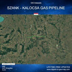 $355
$355GIS Datasets of Szank – Kalocsa Gas Pipeline: Pipeline Route, Junction Point, Transfer Stations
GIS Datasets with pipeline route turning points and stations coordinates of the 56.5km DN400 Szank - Kalocsa Gas Pipeline in Hungary.
GIS DatasetsJanuary 2026HungaryID16569 -
![[Product Image] Szank - Kalocsa Gas Pipeline](https://digital-oil-gas-map.com/wp-content/uploads/2026/01/Product-Image-Szank-Kalocsa-Gas-Pipeline-300x300.jpg) $40
$40Map of Szank – Kalocsa Gas Pipeline: Pipeline Route, Junction Point, Transfer Stations
Editable and layered digital map of the 56.5km DN400 Szank - Kalocsa Gas Pipeline in Hungary.
Vector MapJanuary 2026HungaryID16560 -
![[Product Image] Szank - Üllés - Algyő Gas Pipeline](https://digital-oil-gas-map.com/wp-content/uploads/2026/01/Product-Image-Szank-Ulles-Algyo-Gas-Pipeline-300x300.jpg) $40
$40Map of Szank – Üllés – Algyő Gas Pipeline: Pipeline Route, Junction Points, Transfer Stations
Editable and layered digital map of the 57km DN300 Szank - Üllés - Algyő Gas Pipeline in Hungary.
Vector MapJanuary 2026HungaryID16552 -
![[Product Image] GIS Datasets of Kardoskút - Városföld Gas Pipeline](https://digital-oil-gas-map.com/wp-content/uploads/2026/01/Product-Image-GIS-Datasets-of-Kardoskut-Varosfold-Gas-Pipeline-300x300.jpg) $341
$341GIS Datasets of Kardoskút – Városföld Pipeline: Pipeline Route, Underground Gas Storage, Compressor Station, Transfer Stations, Block Valve Station
GIS Datasets with pipeline route turning points and stations coordinates of the 82km DN400 Kardoskút - Városföld Gas Pipeline in Hungary.
GIS DatasetsJanuary 2026HungaryID16536 -
![[Product Image] Kardoskút - Városföld Gas Pipeline](https://digital-oil-gas-map.com/wp-content/uploads/2026/01/Product-Image-Kardoskut-Varosfold-Gas-Pipeline-300x300.jpg) $60
$60Map of Kardoskút – Városföld Pipeline: Pipeline Route, Underground Gas Storage, Compressor Station, Transfer Stations, Block Valve Station
Editable and layered digital map of the 82km DN400 Kardoskút - Városföld Gas Pipeline in Hungary.
Vector MapJanuary 2026HungaryID16530 -
![[Product Image] Városföld - Adony Gas Pipeline](https://digital-oil-gas-map.com/wp-content/uploads/2026/01/Product-Image-Varosfold-Adony-Gas-Pipeline-300x300.jpg) $60
$60Map of Városföld – Adony Gas Pipeline: Pipeline Route, Compressor Station, Junction Point, Transfer Stations
Editable and layered digital map of the 88km Városföld - Adony Gas Pipeline in Hungary.
Vector MapJanuary 2026HungaryID16524 -
![[Product Image] GIS Datasets of Kápolnásnyék - Pétfürdő Gas Pipeline](https://digital-oil-gas-map.com/wp-content/uploads/2026/01/Product-Image-GIS-Datasets-of-Kapolnasnyek-Petfurdo-Gas-Pipeline-300x300.jpg) $257
$257GIS Datasets of Kápolnásnyék – Pétfürdő Pipeline: Pipeline Route, Gas Transfer Stations, Block Valve Station
GIS Datasets with pipeline route turning points and stations coordinates of the 52km DN300 Kápolnásnyék - Pétfürdő Gas Pipeline in Hungary.
GIS DatasetsJanuary 2026HungaryID16517 -
![[Product Image] Kápolnásnyék - Pétfürdő Gas Pipeline](https://digital-oil-gas-map.com/wp-content/uploads/2026/01/Product-Image-Kapolnasnyek-Petfurdo-Gas-Pipeline-300x300.jpg) $40
$40Map of Kápolnásnyék – Pétfürdő Pipeline: Pipeline Route, Gas Transfer Stations, Block Valve Station
Editable and layered digital map of the 52km DN300 Kápolnásnyék - Pétfürdő Gas Pipeline in Hungary.
Vector MapJanuary 2026HungaryID16506 -
![[Product Image] GIS Datasets of Jánosháza - Répcelak - Sopron Gas Pipeline](https://digital-oil-gas-map.com/wp-content/uploads/2026/01/Product-Image-GIS-Datasets-of-Janoshaza-Repcelak-Sopron-Gas-Pipeline-300x300.jpg) $434
$434GIS Datasets of Osi – Ajka – Devecser Gas Pipeline: Pipeline Route, Gas Transfer Stations
GIS Datasets with pipeline route turning points and stations coordinates of the 67.5km DN400 Osi - Ajka - Devecser Gas Pipeline in Hungary.
GIS DatasetsJanuary 2026HungaryID16499 -
![[Product Image] Osi - Ajka - Devecser Gas Pipeline](https://digital-oil-gas-map.com/wp-content/uploads/2026/01/Product-Image-Osi-Ajka-Devecser-Gas-Pipeline-300x300.jpg) $50
$50Map of Osi – Ajka – Devecser Gas Pipeline: Pipeline Route, Gas Transfer Stations
Editable and layered digital map of the 67.5km DN400 Osi - Ajka - Devecser Gas Pipeline in Hungary.
Vector MapJanuary 2026HungaryID16489 -
![[Product Image] GIS Datasets of Kapuvár - Répcelak Gas Pipeline](https://digital-oil-gas-map.com/wp-content/uploads/2026/01/Product-Image-GIS-Datasets-of-Kapuvar-Repcelak-Gas-Pipeline-300x300.jpg) $88
$88GIS Datasets of Kapuvár – Répcelak Gas Pipeline: Pipeline Route, Gas Transfer Stations
GIS Datasets with pipeline route turning points and stations coordinates of the 17.4km DN400 Kapuvár - Répcelak Gas Pipeline in Hungary.
GIS DatasetsJanuary 2026HungaryID16476 -
![[Product Image] Kapuvár - Répcelak Gas Pipeline](https://digital-oil-gas-map.com/wp-content/uploads/2026/01/Product-Image-Kapuvar-Repcelak-Gas-Pipeline-300x300.jpg) $20
$20Map of Kapuvár – Répcelak Gas Pipeline: Pipeline Route, Gas Transfer Stations
Editable and layered digital map of the 17.4km DN400 Kapuvár - Répcelak Gas Pipeline in Hungary.
Vector MapJanuary 2026HungaryID16467